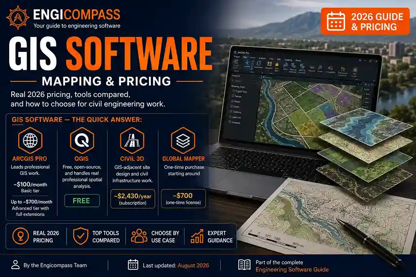
GIS software maps and analyzes spatial data — where things are, and what that location means for a project. Civil and environmental engineers use it for site planning, drainage design, and environmental impact work. ArcGIS Pro leads the paid tier, and it’s genuinely expensive. QGIS, its free counterpart, now handles most of the same real work at zero cost. Which one you need depends on your budget and how deep your analysis actually goes.
GIS software — the quick answer:
- ArcGIS Pro leads professional GIS work. Basic tier pricing runs around $100/month, climbing toward $700/month for the Advanced tier with full extensions.
- QGIS is free, open-source, and handles real professional spatial analysis, not just basic mapping.
- Civil 3D, already covered in the BIM software guide, handles GIS-adjacent site design and civil infrastructure work specifically.
- Global Mapper takes a different pricing model entirely: a one-time purchase starting around $700, not a subscription.
This guide is part of the complete engineering software guide, covering every category from CAD to enterprise tools.
By the Engicompass Team · Last updated: August 2026What does GIS software actually cover?
GIS stands for Geographic Information Systems, and at its core, it answers questions that depend on location. Where does this floodplain actually reach? Which parcels does this pipeline cross? How does elevation change across this site? A spreadsheet can hold the data behind those questions, but only GIS software can show how that data behaves in physical space.
Mapping and spatial analysis
Mapping is the visible part — turning raw location data into a readable map layer. However, the real value of GIS software sits in spatial analysis: layering multiple datasets together (terrain, zoning, utilities, environmental data) and finding relationships a flat map alone can’t show. For instance, a civil engineer checking whether a proposed road crosses a protected wetland is doing spatial analysis, not just looking at a map. That same layered approach applies to flood modeling, utility conflict checks, and site suitability studies. All of these depend on combining several data layers at once, rather than reading any single map in isolation.
Site planning and environmental work
For civil and environmental engineers specifically, GIS software drives site planning, drainage modeling, and environmental impact assessment. These projects depend on real-world geography — slope, soil type, flood zones, existing infrastructure. GIS is the tool that turns that geography into something a design can actually account for, instead of guessing from a paper map. Regulatory submissions, in particular, often require GIS-generated maps and data specifically, since agencies increasingly expect digital, analyzable data rather than a static drawing.
What are the top GIS tools?
ArcGIS Pro, from Esri, leads professional GIS work by a wide margin. It’s the platform most government agencies, environmental firms, and large civil engineering practices standardize on. Esri’s own pricing structure runs through named “user types” — Basic, Standard, and Advanced — rather than a single flat price. Basic tier access runs around $100/month. The Advanced tier, with the full set of extensions, can run $700/month or more. Notably, there’s no free version and no trial through most channels.
QGIS is free, open-source, and has closed the capability gap with ArcGIS considerably in recent years. It integrates deeply with GRASS GIS for advanced raster and hydrological analysis, and its plugin ecosystem extends functionality quickly, often faster than Esri ships equivalent features. As a result, for organizations without a dedicated GIS department, QGIS frequently covers the same real work at zero licensing cost.
Civil 3D, from Autodesk, sits at the intersection of CAD and GIS rather than being a pure GIS tool. It’s already covered in depth in the BIM software guide. Civil engineers typically reach for it for site design, grading, and infrastructure work alongside — not instead of — a dedicated GIS platform. Pricing runs about $2,430/year, consistent with the figure verified there.
Global Mapper, meanwhile, takes a genuinely different approach to pricing: a one-time purchase starting around $700, rather than a subscription. For teams that want to own a license outright instead of renting one indefinitely, this is worth a serious look, particularly for drone and terrain-analysis workflows where it has real strength.
MapInfo Pro is a smaller but real alternative, more common in specific regional markets than ArcGIS. Like many enterprise GIS tools, it doesn’t publish public pricing, so expect a sales conversation instead of a checkout page.
How does GIS software compare on features and pricing?
| Tool | Category | Best for | Verified price |
|---|---|---|---|
| ArcGIS Pro | Enterprise GIS | Government, environmental firms, large civil practices | ~$1,200–$8,400+/year (Basic to Advanced) |
| QGIS | Open-source GIS | Any budget, real professional spatial analysis | $0 |
| Civil 3D | CAD/GIS hybrid | Site design, grading, civil infrastructure | ~$2,430/year |
| Global Mapper | Desktop GIS | Terrain and drone data, one-time ownership | ~$700 one-time |
| MapInfo Pro | Enterprise GIS | Regional/specialized deployments | Custom-quoted, no public price |
<div class=”ec-answer”> <strong>Worth remembering:</strong> prices checked August 2026. GIS software licensing, especially Esri’s tiered user-type model, varies significantly by organization size and module selection — confirm the current figure directly with the vendor before purchasing. </div>
How do you choose GIS software by use case?
Students and independent learners should start with QGIS. It’s genuinely free, not a trial, and the skills transfer directly to ArcGIS later if a job requires it. Esri also offers free training through its own Learn ArcGIS platform, so cost isn’t a barrier to learning either tool.
Civil engineering firms doing site design and infrastructure work typically need Civil 3D as their primary tool. The GIS software fills a supporting role here, handling environmental constraints, zoning, and regional planning data that sit outside what a design platform covers directly. In practice, this often means Civil 3D handles the design work while QGIS or ArcGIS handles the surrounding analysis that informs it.
Environmental consultancies and government agencies doing deep spatial analysis, especially at scale, generally need ArcGIS Pro. The advanced geoprocessing, enterprise geodatabase support, and official technical support justify the cost once analysis complexity crosses a certain threshold. That threshold, though, is higher than many organizations assume.
Smaller teams and budget-constrained organizations should seriously evaluate QGIS before assuming ArcGIS is required. Given how much the capability gap has narrowed, many organizations doing real professional GIS work now run entirely on the free option, reserving ArcGIS for the rare project that genuinely needs its enterprise-specific features.
What free and student access actually exists?
QGIS is free permanently, for anyone, with no student verification or time limit required.
ArcGIS offers meaningfully discounted student and personal-use pricing through Esri’s education programs, though it’s not free the way QGIS is. Check current student rates directly with Esri, since these change independently of the commercial pricing above.
Global Mapper offers a free trial, though not a permanently free tier the way QGIS does.
Common mistakes to avoid
Buying ArcGIS before confirming QGIS can’t cover the work. Given how much capability QGIS now offers at zero cost, paying for ArcGIS without a specific, identified gap it fills is a real budget mistake for smaller teams.
Treating Civil 3D as a GIS replacement. It handles civil design and grading well, but it isn’t built for the kind of multi-layer spatial analysis dedicated GIS software does. Teams doing serious environmental or regional analysis need both, not one instead of the other.
Underestimating ArcGIS’s tiered pricing structure. The jump from Basic to Advanced user types is substantial, and many organizations end up needing Advanced-tier extensions they didn’t budget for at the start. Therefore, scope the actual analysis needs before committing to a tier, rather than defaulting to whichever tier a sales conversation steers toward.
Ignoring the learning curve difference. ArcGIS Pro’s polished interface can make it feel more approachable initially, but QGIS’s steeper early curve pays off in flexibility once you’re past the basics. In short, don’t choose based on first impressions alone.
What’s next
A dedicated guide comparing GIS tools head to head, plus a full land surveying and mapping software guide and a deep dive into free and open-source GIS options, are still being written. This page will link out to each one as it publishes, becoming the real hub for GIS the same way the CAD & 3D Modeling guide does for that silo.
FAQ
Is QGIS as good as ArcGIS Pro? For most real-world civil and environmental work, yes. QGIS has closed much of the capability gap in recent years, particularly for raster analysis and hydrological modeling. That said, ArcGIS still leads on enterprise geodatabase support, official technical support, and some advanced 3D visualization features, which is where the price difference actually earns its keep.
Do civil engineers need both Civil 3D and a GIS tool? Often, yes. Civil 3D handles site design and grading directly. A GIS tool handles the broader spatial context — environmental constraints, zoning, regional data — that Civil 3D isn’t built to analyze. In other words, they solve different, complementary problems, not the same one twice.
Why doesn’t ArcGIS have a single, simple price? Esri licenses ArcGIS through named user types (Basic, Standard, Advanced) rather than one flat product, since different roles within an organization need meaningfully different capability levels. That structure lets larger organizations mix tiers across their team instead of paying enterprise pricing for every seat.
Is GIS software hard to learn? Basic map-making and simple spatial analysis take a couple of months of consistent practice. Advanced geoprocessing and scripting-level work, however, typically takes a year or more of active use to become genuinely proficient at.
What’s the difference between GIS software and CAD software? CAD designs objects — parts, buildings, infrastructure — at a scale where exact geometry matters most. GIS, by contrast, analyzes location and spatial relationships across a much larger area, where the connection between things matters as much as the exact shape of any one of them.
Can GIS data be shared between ArcGIS and QGIS? Yes, generally. Both support common open formats like shapefiles and GeoJSON, so basic data moves between them reasonably well. Advanced ArcGIS-specific features, though, particularly some geodatabase functionality, don’t always translate cleanly into QGIS.
Does GIS software require special hardware? Not for basic mapping and small-area analysis. Large raster datasets, 3D visualization, and processing over wide geographic areas benefit meaningfully from a stronger CPU and more RAM, similar to the hardware considerations that matter for CAE simulation work.